

Striking details in AFAD's Sındırgı report! 17 cm ground displacement detected after earthquake
AFAD has published a report detailing the effects of the 6.1 magnitude earthquake that occurred in the Sındırgı district of Balıkesir on August 10, as well as the structural damage in the region.



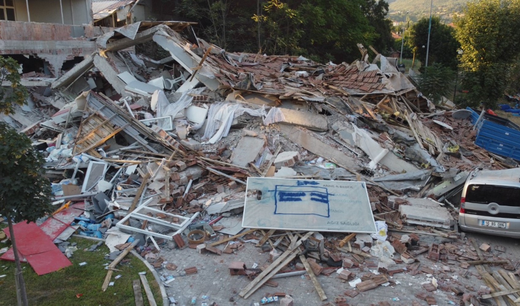
The Disaster and Emergency Management Authority (AFAD) has shared with the public the report it prepared following the 6.1 magnitude earthquake that occurred in the Sındırgı district of Balıkesir on August 10. The report states that the intensity of the earthquake was measured at 8 in the settlements closest to the epicenter and that a vertical deformation of between 15 and 17 cm was detected in the region.
According to the report, one person lost their life as a result of the earthquake, and a total of 1,036 independent units in 729 buildings in Balıkesir and Manisa were heavily damaged or destroyed. This situation has once again highlighted Turkey's shortcomings regarding earthquake preparedness.
TECTONIC STRUCTURE OF THE REGION
AFAD emphasized that the region where the earthquake occurred is located within the Aegean Graben System and that this region is tectonically active. It was stated that 1,464 earthquakes with a magnitude of 4.0 or greater have been recorded in the region since 1900, with the largest being 7.2 in magnitude. Additionally, there are 253 historical earthquake records dating back to the period before 1900.
According to the intensity map created with the Earthquake Pre-Damage and Loss Estimation System (AFAD-RED), the intensity was calculated as 8 in the settlement closest to the epicenter of the earthquake. It was stated that northwest-southeast trending vertical deformations occurred between the Sındırgı Segment at the western end of the Simav Fault Zone and the Gelenbe and Düvertepe Fault Zones.
STRUCTURAL DAMAGE AND CAUSES
The report stated that the structural damage observed in the Sındırgı Earthquake showed similarities to damage in past earthquakes. Factors such as the use of plain reinforcement bars, insufficient numbers of confinement stirrups, improper bending of reinforcement bar ends, weakness in column-beam joints, and the corrosion of some reinforcement bars were cited as the primary causes of the damage. Furthermore, it was emphasized that the age and lack of maintenance of the structures in the region, as well as cracking and separation occurring in load-bearing elements over time, also negatively affected the building stock.
News Source: 12punto
Most Read

Striking picture for Özgür Özel's 'New Party'

Özgür Özel gives a dated response regarding the number of resignations
Forest fire in Antalya brought under control

The PKK opening and Özgür Özel’s path!..

How did the newspapers view Özgür Özel's farewell to the CHP?
Houthis strike Saudi-owned tanker

What did the CHP do?

Özel’s new party move in the world press

The New CHP, against CEHAPE

From self-efficacy to despair