

Will snowfall continue in Istanbul? Icy road warning from the Meteorological Service! Here is the weather forecast for Tuesday, January 20, by province...
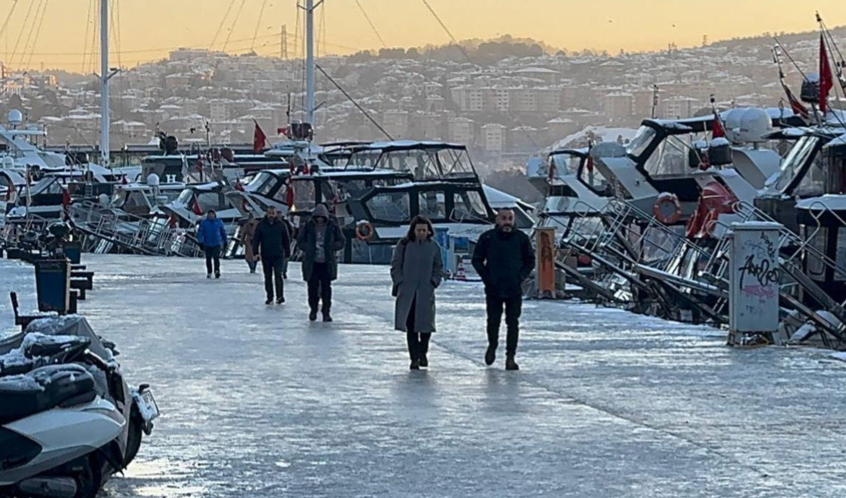
Snowfall has lost its intensity in Istanbul. According to the weather forecast report for January 20 from the General Directorate of Meteorology, rain is expected in the megacity until noon, with sleet in higher elevations. The report emphasized the need to be cautious against frost and icing. So, what will the weather be like across the country today? Here is the weather forecast for Tuesday, January 20, by province...



According to the forecasts made by the General Directorate of Meteorology: The country is expected to be partly to very cloudy, with rain in the surroundings of Istanbul, Sakarya, Kocaeli, the east of Çanakkale, and the north of Balıkesir; sleet in the coastal areas of the Western and Central Black Sea; and snowfall in the surroundings of the Eastern Black Sea, Bilecik, Sivas, Kayseri, Tokat, Erzincan, Kars, Ardahan, Iğdır, Ağrı, Bitlis, Van, Hakkari, as well as the north and east of Erzurum and the eastern parts of Muş.
The precipitation is expected to be heavy snow in the east of Giresun, the west of Trabzon, and the surroundings of Rize and Artvin. The wind is expected to blow strongly (40-60 km/h) from northerly directions in the southwest of Marmara, the North Aegean coasts, the Central and Eastern Black Sea coasts, the southeast of Central Anatolia, and the inland parts of the Eastern Mediterranean. During the night and morning hours, icing and frost are expected in the inland and eastern regions, along with mist and localized fog. There is a risk of avalanches in the high, sloping areas with deep snow cover in the inland parts of the Eastern Black Sea and the east of Eastern Anatolia.
Air temperatures are expected to rise by 3 to 5 degrees in the western parts, with no significant changes expected elsewhere.
The wind is generally expected to be light to occasionally moderate from northerly directions, blowing strongly (40-60 km/h) in the southwest of Marmara, the North Aegean coasts, the Central and Eastern Black Sea coasts, the southeast of Central Anatolia, and the inland parts of the Eastern Mediterranean.
WHAT WILL THE WEATHER BE LIKE IN ISTANBUL?
The snowfall that has been effective in Istanbul for days is giving way to rain. Rain is expected across the city until noon today, with sleet in higher elevations.
While the precipitation is expected to lose its effect significantly in the afternoon, the Meteorological Service, following the Istanbul Governor's Office, issued a warning against the risk of frost. It was reported that icing and frost events may occur, especially as air temperatures drop during the night.
WEATHER ACROSS THE COUNTRY
According to the forecasts, the weather across the country will be partly to very cloudy. Rain, sleet, and snow will continue to be effective in some regions.
REGIONS WHERE PRECIPITATION IS EXPECTED
Precipitation is expected in the surroundings of Istanbul, Sakarya, and Kocaeli, as well as the east of Çanakkale and the north of Balıkesir. Sleet is expected to be effective on the coasts of the Western and Central Black Sea.
MARMARA
It is expected to be very cloudy, with intermittent rain and sleet in Istanbul, Kocaeli, Sakarya, the east of Çanakkale, and the north of Balıkesir, and light snowfall in the surroundings of Bilecik. The wind is expected to blow strongly (40-60 km/h) from northerly directions in the southwest of the region.
BURSA °C, 7°C
Very cloudy
ÇANAKKALE °C, 8°C
Very cloudy, rain and sleet in the east
İSTANBUL °C, 6°C
Very cloudy, light rain and sleet,
KIRKLARELİ °C, 3°C
Very cloudy
AEGEAN
It is expected to be partly to very cloudy. The wind is expected to blow strongly (40-60 km/h) from northerly directions on the North Aegean coasts. During the night and morning hours, icing and frost are expected in the inland parts of the region, along with mist and localized fog.
A.KARAHİSAR °C, 2°C
Partly to very cloudy
DENİZLİ °C, 8°C
Partly to very cloudy
İZMİR °C, 11°C
Partly to very cloudy
MUĞLA °C, 9°C
Partly cloudy
MEDITERRANEAN
It is expected to be partly to very cloudy. The wind is expected to blow strongly (40-60 km/h) from northerly directions in the inland parts of the Eastern Mediterranean. During the night and morning hours, icing and frost are expected in the inland parts of the region, along with mist and localized fog.
ADANA °C, 12°C
Partly to very cloudy
ANTALYA °C, 16°C
Partly cloudy
HATAY °C, 10°C
Partly to very cloudy
ISPARTA °C, 5°C
Partly to very cloudy
CENTRAL ANATOLIA
It is expected to be very cloudy, with intermittent snowfall in the surroundings of Sivas and Kayseri. The wind is expected to blow strongly (40-60 km/h) from northerly directions in the southeast of the region.
ANKARA °C, 3°C
Very cloudy
ESKİŞEHİR °C, 2°C
Very cloudy
KAYSERI °C, -3°C
Very cloudy and intermittent snowfall
KONYA °C, 2°C
Very cloudy
WESTERN BLACK SEA
It is expected to be very cloudy, with sleet and snowfall in the surroundings of Sivas. During the morning and night hours, icing and frost are expected in the inland parts of the region, along with mist and localized fog.
BOLU °C, 2°C
Partly to very cloudy
DÜZCE °C, 4°C
Partly to very cloudy
SİNOP °C, 8°C
Partly to very cloudy
ZONGULDAK °C, 5°C
Partly to very cloudy
CENTRAL and EASTERN BLACK SEA
It is expected to be very cloudy, with intermittent sleet and snowfall on the Central Black Sea coasts, the Eastern Black Sea, and the surroundings of Tokat. The precipitation is expected to be heavy and locally intense snow in the east of Giresun, the west and east of Trabzon, and the surroundings of Rize and Artvin. There is a risk of avalanches in the sloping areas with deep snow cover in the Eastern Black Sea. The wind is expected to blow strongly (40-60 km/h) from northerly directions on the coasts of the region. During the morning and night hours, icing and frost are expected, along with mist and localized fog.
AMASYA °C, 3°C
Very cloudy
RİZE °C, 7°C
Very cloudy, intermittent sleet and snowfall expected. Precipitation is expected to be heavy in the highlands.
SAMSUN °C, 7°C
Very cloudy, intermittent sleet and snowfall
TRABZON °C, 7°C
Very cloudy, intermittent sleet and snowfall expected. Precipitation is expected to be heavy in the east and west.
EASTERN ANATOLIA
It is expected to be very cloudy, with intermittent snowfall in the surroundings of Erzincan, Kars, Ardahan, Iğdır, Ağrı, Bitlis, Van, Hakkari, as well as the north and east of Erzurum and the eastern parts of Muş. There is a risk of avalanches in the sloping areas with deep snow cover in the east. During the night and morning hours, icing and frost are expected, along with mist and localized fog.
ERZURUM °C, -5°C
Very cloudy and intermittent snowfall in the north and east
KARS °C, -5°C
Very cloudy and intermittent snowfall
MALATYA °C, 0°C
Very cloudy
VAN °C, 0°C
Very cloudy and intermittent snowfall
SOUTHEASTERN ANATOLIA
It is expected to be partly to very cloudy. During the morning and night hours, icing and frost are expected in the northern parts of the region, along with mist and localized fog.
BATMAN °C, 4°C
Partly to very cloudy
DİYARBAKIR °C, 3°C
Partly to very cloudy
GAZİANTEP °C, 5°C
Partly to very cloudy
MARDİN °C, 0°C
Partly to very cloudy
News Source: 12punto
Most Read

Galatasaray announces injury updates for Osimhen, Lemina, and Singo

Attention online sellers: Tax monitoring expanded

VAR for the Fenerbahçe-Beşiktaş derby has been announced!

Bridges and highways are being privatized: 15 July and FSM are also on the list

Peugeot September 2026 price list is out

New details emerge in 'panel' operation targeting lawyers

Gökçek era detail in ABB investigation

First statement from Osimhen after injury in Başakşehir match

Özlem Şanver: 'He said he would change, I believed him; should I be beaten just because I didn't leave?'

The Süper Lig's new team becomes the transfer champion